Some photos from a hike up Mt. Elphinstone on Sunday, a destination long gazed at from afar (it's visible from Vancouver). One of those "I must hike that one sometime" mountains. Sunday was sometime.
Caught the early boat over from Horseshoe Bay, seemed absurd to pay the extra and drive so went on as a foot passenger and hiked from Langdale. Photos follow, with the disclaimer that my old super zoom camera is at the end of its life so the tone of these vary pretty wildly.
(click to enlarge)
The tusk on some big zoom from the ferry.
The wake, crossing Howe Sound.
Elphinstone rises above Langdale. Literally the only mountain within eyeshot that's summit is covered with cloud.
The top of Wharf Road is where the trail begins.
And it goes on like this for quite some time, very slowly gaining elevation.
After some route finding challenges following a power line crossing, I ended up making a B-Line up an overgrown trail, disturbing some large mammal in the bushes to hiker's left. And then ended up in this clearcut just north of Langdale Falls.
Descended a steep trail following the "Langdale Falls" signage, but must have overshot the falls and didn't have too much time to find it, so carried on.
Trail up the other side of Langdale Creek, getting close to the actual Elphinstone Summit trail now.
One of the nicer bits of the Elphinstone Summit trail. The trail was in large part the product of the late legendary mountaineer, Dick Culbert's labour.
The trail gains elevation very slowly until its final km or so. This is the first hint of the views to come.
Higher up there are some marshy bits.
At the true summit now, which offers views to the north.
And a few minutes away there are other viewpoints offering views towards Vancouver.
Mt. Baker looms above the distant valley.
I think the prominent road is Kingsway as I see Elphinstone pretty clearly while commuting it.
Without all the zoom, Vancouver is trickier to spot, at left, beyond Mt Gardner on Bowen Island.
Super zoom of Delta, Pt Roberts and beyond to Lummi Island (passing as Mt. Rainier lol).
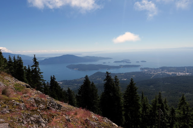
View down to Gibsons with Keats and Bowen Isls at left.
On the lower slopes en route back to the ferry.
Elphinstone framed by the vehicle ramp at Langdale terminal.
The MV Queen of Coquitlam (44 years young this year), with Sky Pilot Mountain group beyond.
Zoom on Sky Pilot group. Ledge Mountain looks particularly impressive from this vantage point.
Lions Bay area peaks; Hat, Brunswick, Harvey, West Lion, Unnecessary.
Closer look at Hat, Brunswick and Harvey from the ferry.
St. Mark's summit from the ferry....
Can't quite see the 'grammers up on St. Mark's yet.
But you can now!
Overall, the trip to Elphinstone was a good long day of hiking from the Langdale terminal, 22.5km with about 1350m of cumulative elevation gain, lots by my recent standards! The main trail is a beautiful one, though some care is required on connecting to it from the terminal. The elevation gain is slow which at times feels like a slog and the views are pretty nice, if not quite in the league of the HSCT peaks. Glad to have got this hike done!


